
Eduard
Eduard creates beautiful and accurate Swiss-style shaded relief images for maps.
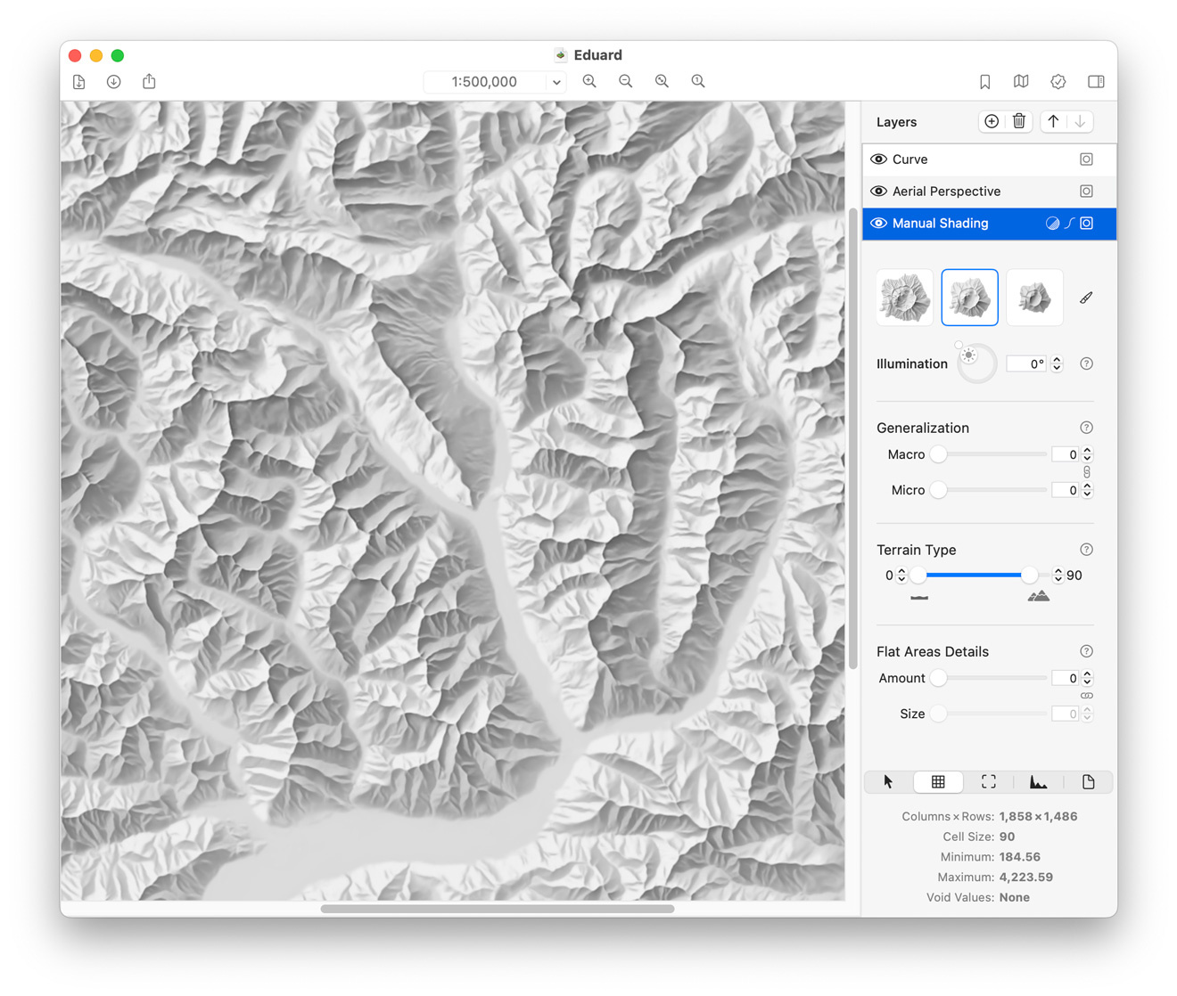
Eduard is a relief shading app for cartographers who create terrain maps.
Eduard for macOS
Eduard for macOS is a feature-rich desktop application available on the App Store.
If you use a Mac, we recommend Eduard for macOS for the best experience.
Eduard Cloud
Eduard Cloud runs in any modern web browser on Windows, macOS and Linux.
We recommend Eduard Cloud if you don't have a Mac or only need to create a small number of shaded reliefs.
Awards

Prix Carto 2023 of the Swiss Society of Cartography.
3rd place for Digital Products at the International Cartographic Conference 2023.
Download Eduard for macOS
Download Eduard for macOS on the App Store or download a free demo. Eduard Demo does not include import and download functionality.
Eduard for macOS requires macOS 14 or later; macOS 15 or macOS 26 is recommended. Eduard supports Macs with Intel and Apple M CPUs.
Latest Updates
Eduard Cloud:
6 November 2025: Version 1.0.2 with various bug fixes.
12 October 2025: Version 1.0 released. A big thank you to all beta testers!
Eduard for macOS 1.4.15: 11 November 2025
Replace void values with smooth feathering; export grids to small 16-bit GeoTIFF files with decimeter precision; various improvements and bug fixes.
Swiss-style Shading with Machine Learning
Machine learning in Eduard enables cartographers to create Swiss-style shaded relief within seconds from digital elevation models.
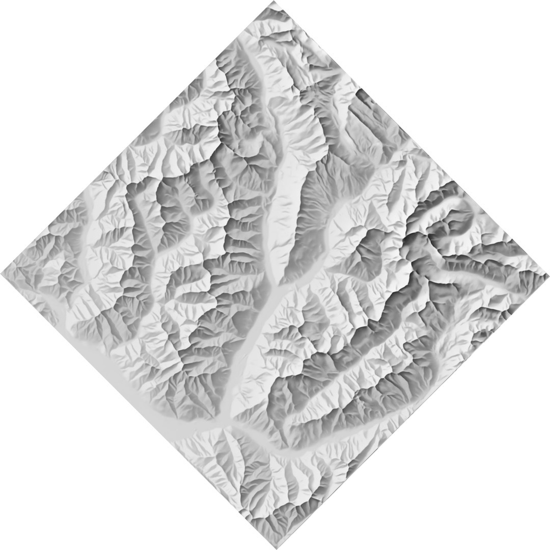
Light Rotation
You define the overall direction of illumination and Eduard locally adjusts the direction of illumination to show small details and emphasize large landforms.
Left: top-left illumination. Right: bottom illumination.
Map Rotation
Eduard rotates the shading and the direction of illumination to fit your map.
Map rotation is only available in Eduard for macOS.
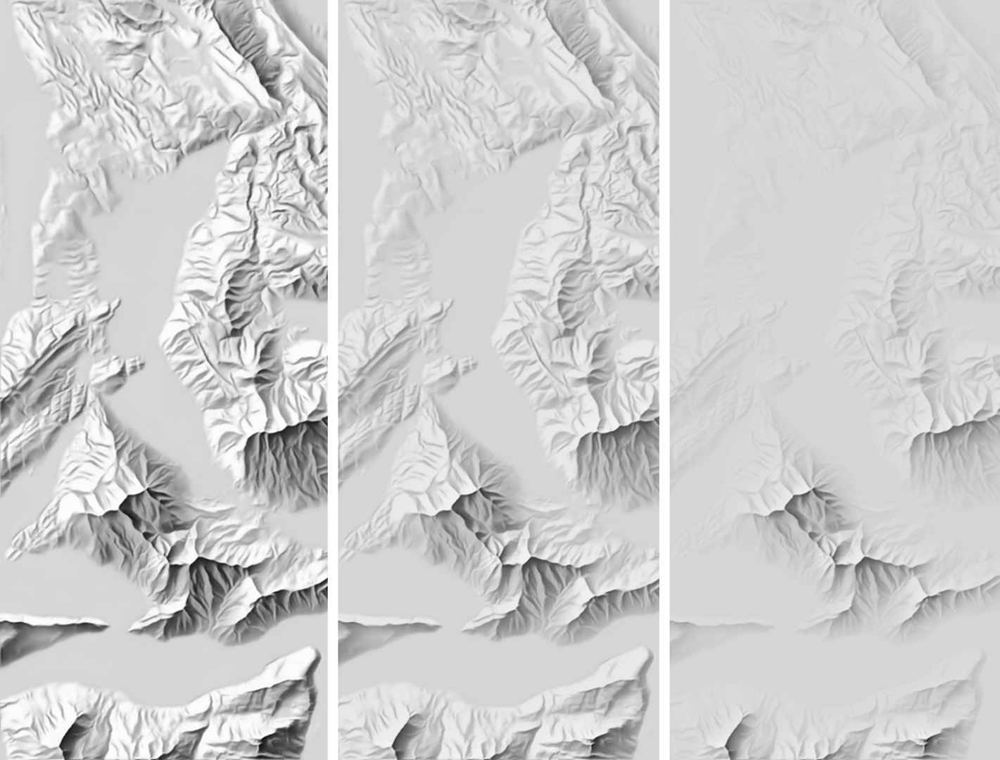
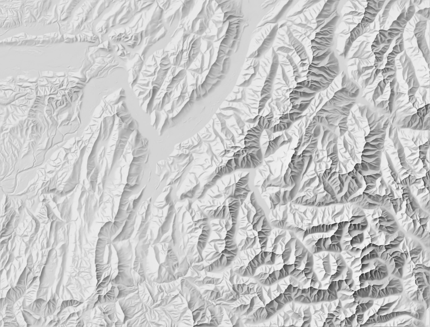
Aerial Perspective
Eduard makes mountain peaks stand out or gives all landforms the same prominence.
Aerial perspective increases from left to right.
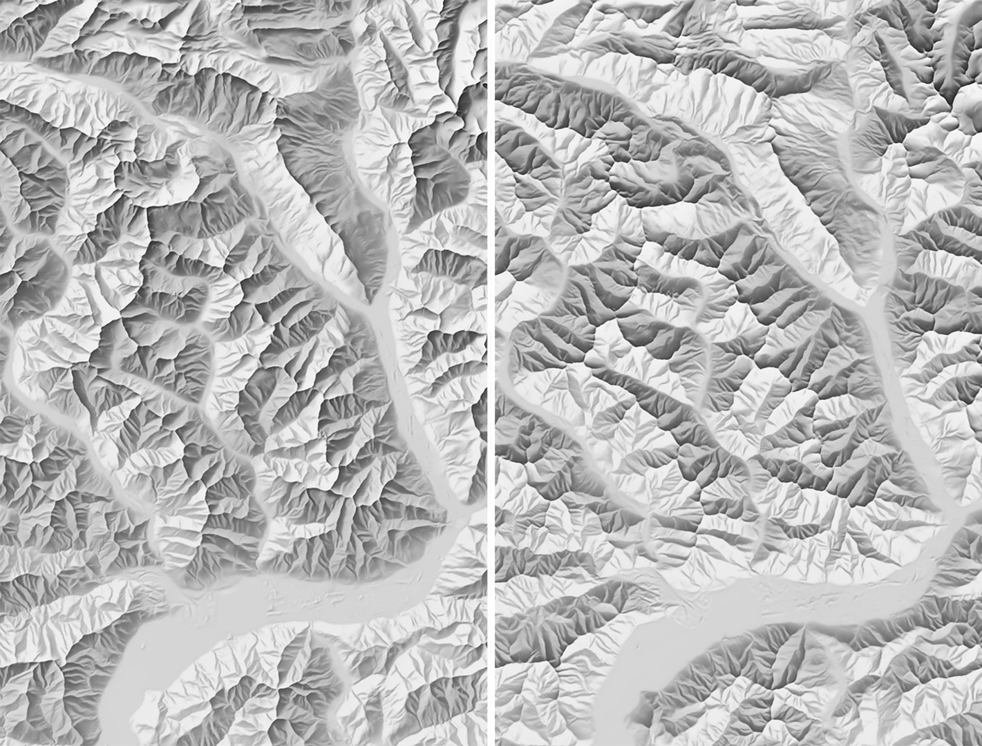
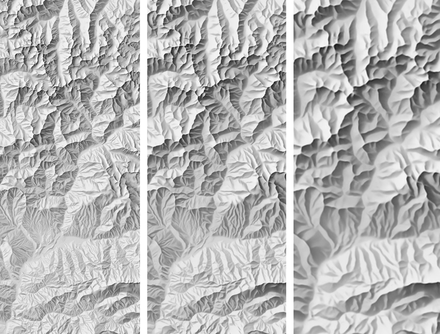
Generalization
Eduard helps you to remove distracting terrain details and adjust the granularity of the shading to the scale of your map.
Generalization increases from left to right.
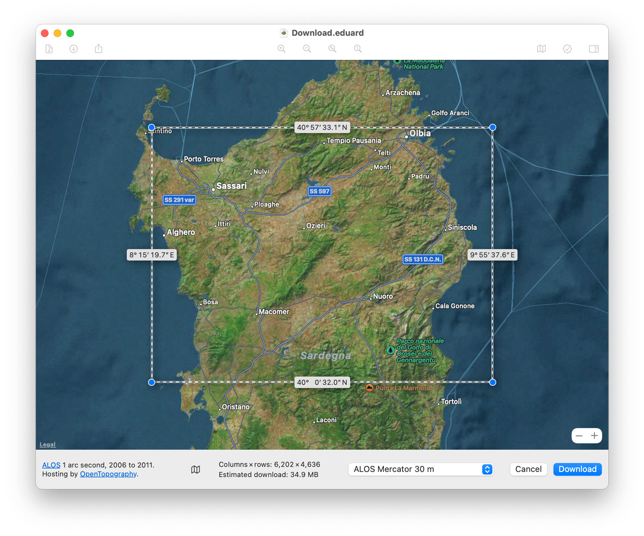
Elevation Data
With Eduard you can quickly download elevation data from almost anywhere on Earth* or import all common elevation file formats**.
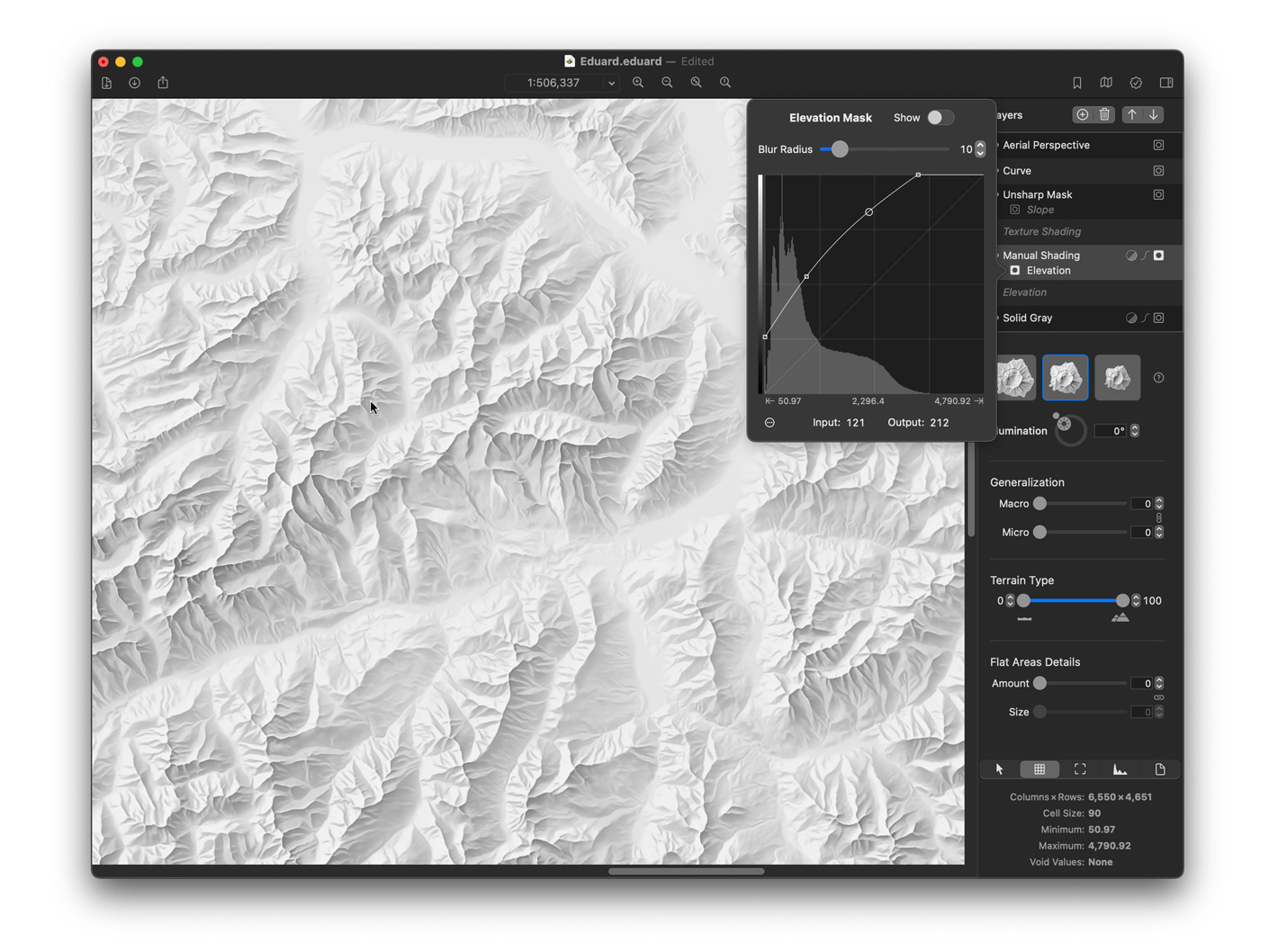
Layers, Masks and Curves
Combine shading layers, adjust opacity and blending modes, mask layers by terrain elevation or slope, adjust contrast and brightness with curves, apply aerial perspective, and blur or sharpen layers.
Layers, masks and curves are only available in Eduard for macOS.
Introducing Eduard
Watch Eduard for macOS being introduced at the NACIS 2022 conference.
The presentation includes demos of Eduard's main features.
A Tour Through Eduard for macOS
by Jess Jess Zimmerman, TheMapGuy.net
What others say about Eduard
“Bravo! The relief output looks fantastic and I think this is a game changer for anyone wanting to replicate the Swiss style.”
Martin Gamache, Chief Cartographer, National Geographic Society
“Back in the old days, drawing a manual relief would take me weeks to complete. With Eduard, you can create a manual-style relief in minutes.”
Tom Patterson, US National Park Service (ret.) and author of shadedrelief.com
“Amazing cartographic software!”
Alex Tait, The Geographer, National Geographic Society
“Eduard ❤️ must have this! I just decided that I'll be using a Mac so I can make gorgeous shaded relief and save a million hours by using Eduard. Super intuitive interface, exports play well with Esri, and the results are quick and beautiful. I'm still swooning 😍”
Alethea Steingisser, InfoGraphics Lab, University of Oregon
“I am a bit humbled by what Eduard produced in short order.”
Nick Martinelli, Apple Maps
“This software is amazing.”
Matthew Hampton, Lead Cartographer, Metro Portland, OR.
“For the first 15 years of my career I strived, and failed, to create relief maps approaching the quality of Eduard Imhof's. Now with the release of Eduard [...], I think we're there.”
Jo Wood, City University, London
“Eduard Relief Shading for beautiful, first rate, serious gradient maps.”
Edward Tufte
“Aside from the exquisite shading that Eduard produces (!), the stability & memory management are nothing short of magical. Here's an 11.7GB .asc DEM that I cobbled together with outliers, holes, etc. Eduard ..just..works.. using ~3GB of memory.”
Jamie Robertson, Cartographer, Cairn Cartographics
“Can confirm that Eduard is awesome AND super fun. So is Crater Lake.”
Chaney Swiney, Cartographer, Benchmark Maps
“This software is absolutely amazing.”
Mike Boruta, Cartographer
User Guide
Privacy Policy
We take your privacy seriously. We do not collect any of your personal data. Our customer records are not for sale or trade, and we will not disclose our customer data to any third party except as may be required by law.
Any information that you provide to us via email or other forms of communication is held in strict confidence. This includes your contact information (including your email address), as well as any data that you supply to us.
Third-party Services: You can use Eduard to download elevation data from OpenTopography and AWS Amazon (Mapzen). You can consult the OpenTopography privacy policy and the Amazon AWS privacy policy.
General Terms of Use
The Apple App Store terms and conditions apply when Eduard is purchased via the Apple App Store. The authors of Eduard do not retain any right to content, such as images or maps, that is created with Eduard.
Acknowledgements
The authors of Eduard thank the National Gegoraphic Society for its contribution through an Explorer Grant and other support.